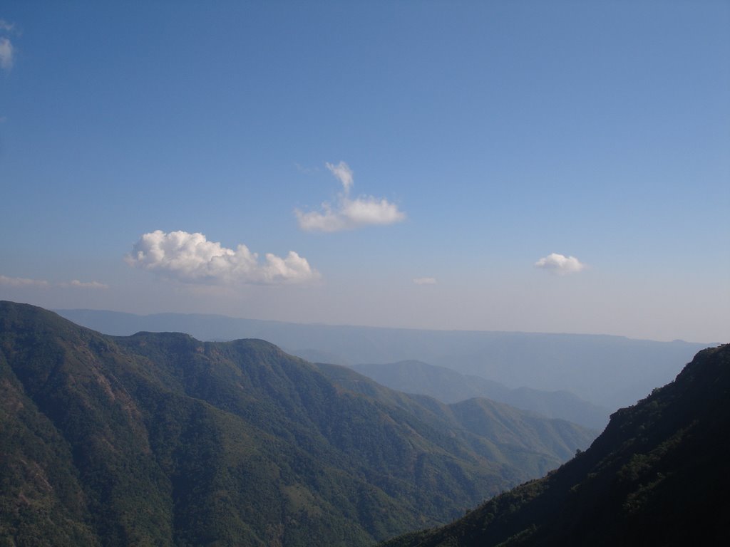
 When I was young, every visit to Sohra was filled with a mixed of excitement and awe. While still on the way, I would visualize those massive green mountains rising from the deep valleys to flirt with the clouds. The land is characterized by sheer beauty and ruggedness that leave many a traveler awestruck and breathless.
Sohra also known as Cherrapunjee is one of the world's wettest places where the average yearly rainfall of 450 inches (1143 cms). Mawsynram, a village about 30 kms west of Sohra, has recently earned the title of the world's wettest spot with an average annual rainfall of 467 inches (1186 cms). For those who are interested, Mt. Waialeale on the island of Kauai in Hawaii ia also among the top wettest places in the world with 460 inches (1168 cms) of rain per year. The rainfall on Mt. Waialeale is spread over 12 months, while Sohra gets almost all of its rain in the six monsoon months of April through September.
 Sohra rain facts:
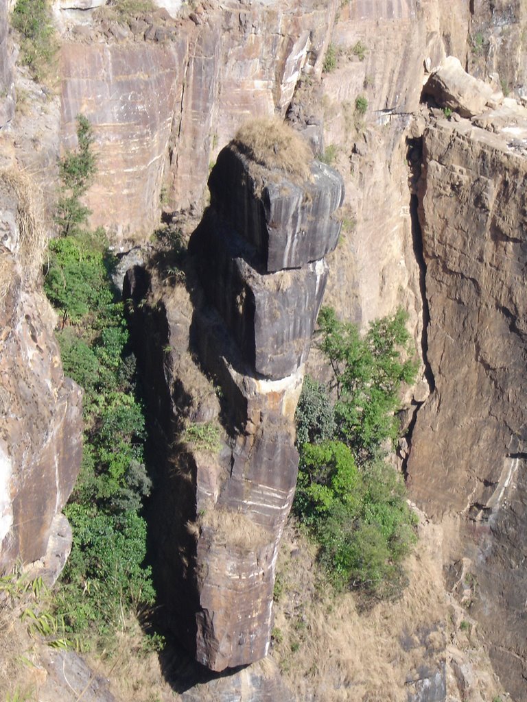
The terrain rises steeply from the India-Bangladesh border to Sohra, which sits at an elevation of 4,500 feet (1372 m). After passing over the Bangladesh Plains, the monsoon clouds hit Sohra with a vengeance. A world record 1,042 inches (2647 cm) of rain fell between August 1860 and July 1861. More recently, the year 1974 saw 967 inches of rain with an astounding 323 inches in just the month of July. That's 10 inches (25 cm) a day for an entire month! There is only one kind of downpour that comes to mind, the one that came when Noah's Ark was completed. On June 16, 1995, a record 62 inches of rain fell in just 24 hours.
I took a trek with my friends to the 'living root bridge', the much talked about spectacle, in December 2005. There are in fact quite a number of these root bridges that have formed along the supports constructed by the villagers over streams and rivers so that people can cross from one side to the other. The roots of the trees, which have gr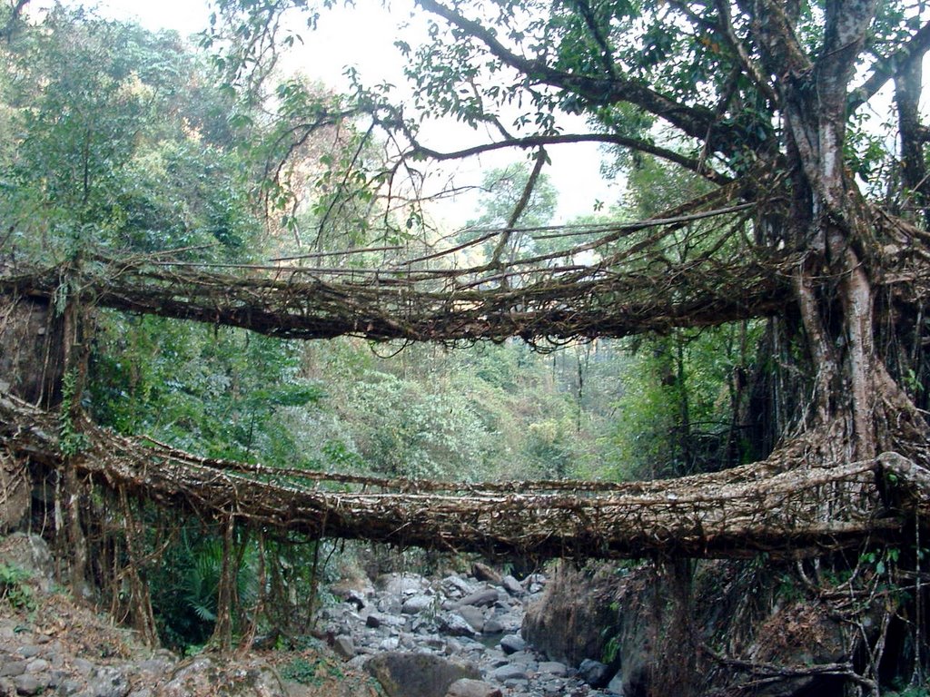 own above the ground would grow, entertwine and spread along the supports and ultimately form a living root bridge. The village we trekked to was Nongriat about 20 kms from Sohra. It took more than 2 hours to trek to the doubled storeyed living root bridge, and along the way, we crossed few root bridges and also one made of steel wires that was constructed by the government. The journey was very tiring indeed and every sinew in my body ached as we navigated through the rough unsuspecting terrain. But the sight that greeted us was worth those drops of prespiration that rained on the ground along the way. It was unimaginable that local knowledge and wisdom could make use of trees in this manner. It almost looked like a scene out of a 'Tarzon' comic. We stopped, absorbed the wonder, then clicked pictures by the dozens...until we heard one of our trekmates' call from the village ahead becknoning us to taste the locally made fruit juice which he was sipping from a mug. Then we all ran and ambushed him.
To discover Meghalaya and the rest of the North East India please do visits my friend James Perry's site below.
No comments:
Post a Comment